I have long been fascinated by Thailand’s many “ghost roads”; roads that appear on maps, but don’t actually exist.
One of the more interesting “ghost roads” is the imaginary 1117 that is supposed to wind over the Mokochu Mountain range through Mae Wong National Part to connect Kamphaeng Phet to Umphang-
In reality the road ends at the Chong Yen summit:
Some friends were keen to go exploring up north so on the morning of December 13th we met up bright and early in front of the Paddock on Ratchadapisek and hit the road!
Satonic, who is not known as a morning person, was only a wee bit late, arriving on the D-tracker he had just purchased the day before! No time to get dirt wheels, he was going to have a go on standard 17″ road wheels and IRC street tires- brave or nuts? Jury is still out! ![[IMG]](https://i0.wp.com/teakdoor.com/images/smilies/mid.gif)
Once we’d escaped Bangkok and were on the road to Nakhon Sawan we made a brief brekkie stop at McD’s
Clowning around ![]()
I discovered that my KLX 351 gets terrible mileage on the highway. Whacking along at ~110-120kph on off road knobblies I was lucky to get 130-140km out of my 3 gallon (11 liter) IMS tank, not that I ever ran it dry. Off road I can usually get close to 200km/tank… Anyway, the seat is so uncomfortable on long hauls that it’s a relief to make frequent gas stops and give my backside a rest!
We made good time to Nakhon Sawan and just past the Nakhon Sawan bypass we turned off on the 1072 headed west, stopping at Lat Yao for a quick lunch, then continuing west / northwest on the 1072 and finally hanging a left onto the 1117 that winds up to Mae Wong National Park-
They wanted to charge us the “tourist price” but we flashed our Thai drivers licenses and they reluctantly let us in at the “local” price, and we enjoyed a fun ride up to the National Park Visitor Center. Great road the 1117!
Parts were being resurfaced and all that loose gravel was good fun on a dirt bike, but Satonic was hating it on his motard…
When you arrive at the Visitor Center they will not let you proceed on up the road unless you register first-
Arriving at the Visitor Center in Mae Wong National Park-
They have beautiful cabins for rent and I would love to come back here with the kids some day- lots of wildlife, waterfalls, rapids, hiking etc. There isn’t much English-language information about this park, and the visitor center didn’t even have any park maps to offer us, but I found this one on the norththailandbirding site:
We wandered about the Visitor Center area a bit to stretch our legs and enjoy the cool mountain air-
Aloha from Mae Wong National Park, Thailand!
The staff were very friendly and told us that we could ride up to the Chong Yen summit if we registered. (Registration is free)
The visitor center overlooks a nice waterfall- you can’t really make it out in this pic…
Satonic posing for a shot with the Mae Wong falls and river in the background-
Having registered at the visitor center we are given a registration slip that we pass to the guard who then allows us to proceed on up the 1117-
Mae Wong National Park is one of the last areas in Thailand that has Tigers and there is a huge controversy going on in recent years due to the government’s plan, announced in 2012, to build a dam on the Mae Wong river that will flood the tigers’ most critical habitat.
The dam will destroy around 1,760 hectares (17.6 square-kilometers) of low-lying forest, which is the prime habitat for the tiger. There have been huge protests over this dam; I had no idea and am pleasantly surprised to discover that Thailand boasts such a robust environmental movement-
More about the Mae Wong dam controversy-
Fortunately with millions of anti-government protesters taking to the streets in recent weeks it seems this government’s days are numbered so hopefully the dam will never be built!
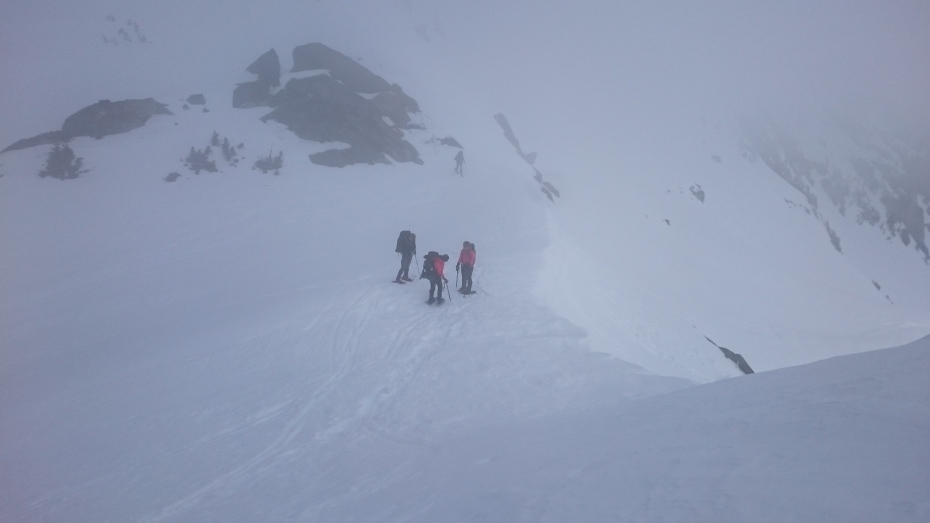
We climbed up and up and up the 1117 towards the Chong Yen summit, some ~28km from the Visitor Center.
This is my first trip with a “real” GPS and while I’m still learning how to use it, it’s kinda cool to see where we’ve been and be able to look at elevation profiles. This is the climb up to the 1329 meter Chong Yen viewpoint and campground in Mae Wong National Park:
![[IMG]](https://i0.wp.com/www.asianconnection71.com/MaeWongElevationProfile.jpg)
The road is narrow but mostly in good repair at least up until you reach the Nam Yen viewpoint and campsite. After Nam Yen it’s pretty rough, no problem for dirtbikes and certainly doable on a roadbike if you just go slow and take it easy.
Roughly ~16km up from the Visitor Center I pulled off at the Kiew Krating viewpoint to check out the views and let the fellows to catch up-
Unfortunately it was a very hazy day so the views were quite obscured… We saw pictures in the Visitor center taken on clear days that showed amazing views.
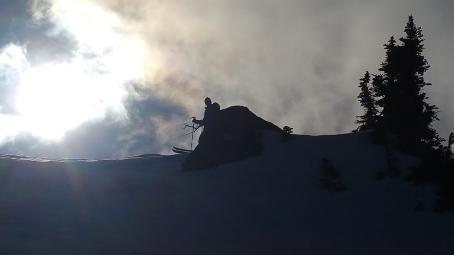
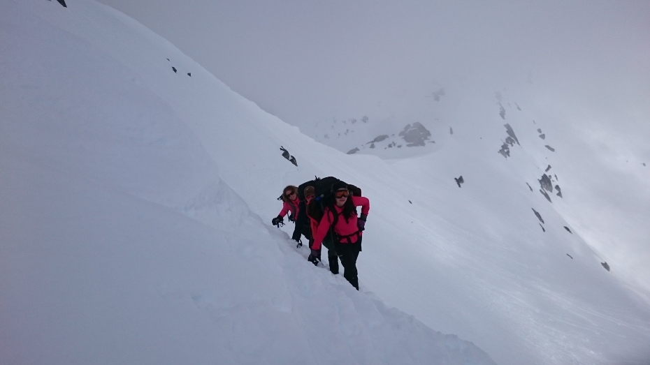
Here comes Satonic-
Satonic and Tony at the Kiew Krating Viewpoint in Mae Wong National Park!
Another 12km to Chong Yen-
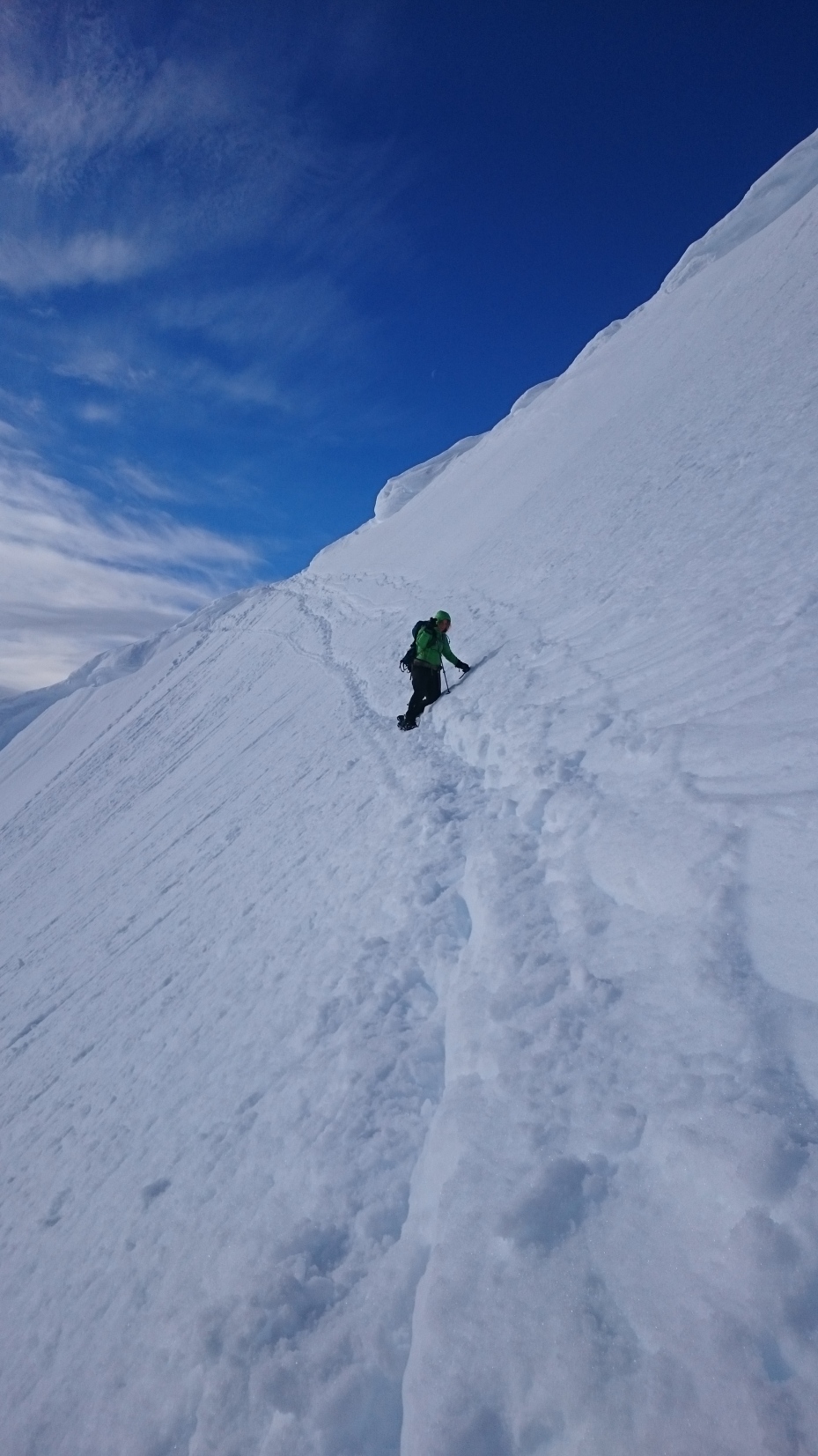
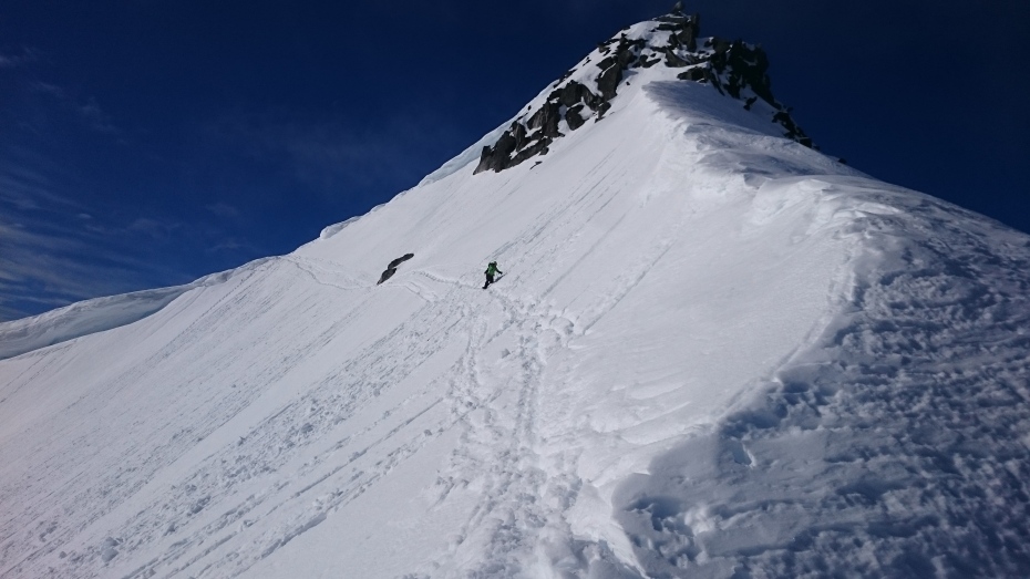
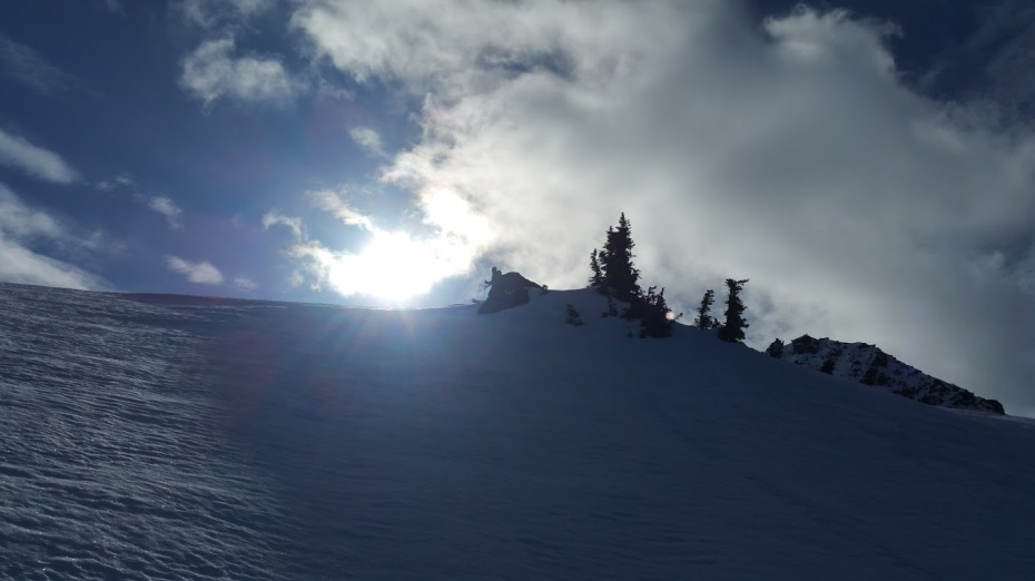
From Kiew Krating it’s another 12km of busted up pavement to the END OF THE ROAD at Chong Yen-
Here the “road” ends and there is only a narrow footpath that disappears into heavy forest-
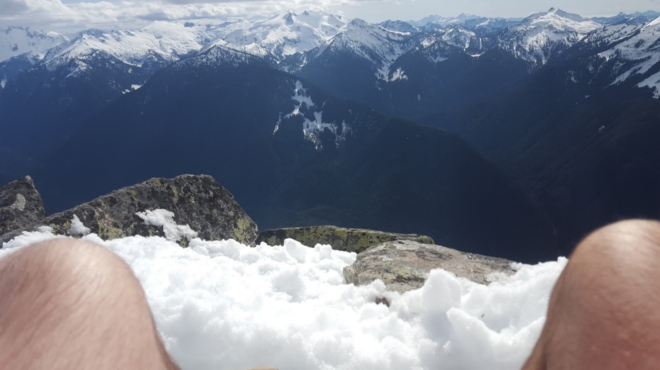
Chong Yen, 1340 meters, Mae Wong National Park!
I knew the road didn’t go through, but always wanted to see for myself- I hiked down the trail a little ways and from the little bit that I saw I think this could be quite a challenge on dirt bikes!
A friendly ranger told us that the trail goes for about 15km before it reconnects with a road to Umphang. He said it could be hiked but that bikes could not use the trail. I understand that bikes aren’t allowed on the trail, but what I was trying to figure out is if it’s POSSIBLE for a bike to get through on the trail. Unfortunately with my weak Thai I could not get this across to the ranger and he just kept saying no bikes on the trail…
This way to Umphang!! Some day I’d really like to hike this trail, and if it seems possible to get through on a bike I reckon one out to try to approach from the Umpang side, as the approach from the East is “guarded” as it were by Mae Wong National Park. They record your name and license plate number to get up the road to Chong Yen, so if one were to simply continue there is the risk they could track you down and prosecute if they are so inclined… I’m not keen to step on any toes or break any laws, but it would be pretty cool to ride this “Missing Link” between Kamphaeng Phet and Umphang some day!
As with Kiew Krating 12km down the road, the views from Chong Yen were obscured by haze.
The road ends at the campground and trailhead, but I spotted another trail that leads up the actual summit of the mountain. It didn’t look so far so I set off to reach the peak. Actually the trail was stupid steep!
In hindsight, it would have been a lot easier if I hadn’t been hiking in enduro boots and full armor!
Finally I reached the summit!
Still hazy, but the views from up here were quite a bit better than down below-
In this pic you can just make out, in the center of the photo, the Nam Yen viewpoint and campground-
Time to head back down to the bikes- the hike up here took longer than I expected and I was sure that the fellas were probably getting anxious to hit the road as it was getting late and we still had some distance to cover.
I enjoyed coasting down the steep road in neutral with the engine off, pretending the KLX is just a big mountain bike, and scared the crap out of some folks who were slowly working their way through a particularly busted up section of road- someone in the car actually screamed as I rolled by in stealth mode.
Before leaving the park Satonic and I made a quick side trip to the Kaeng Pa Nang Roy rapids.
Lovely spot with camping- some nice Thai guys were setting up their tent right next to the rapids.
I invented a new sport I call “enduro-yoga” 😉
Big thumbs up for the Kaeng Pa Nang Roy rapids in Mae Wong National Park!
From Mae Wong National Park we rode a bit further north to the town of Tak on the Ping River. Little did we know but there was a biker party in Tak that night and we had a heck of a time finding a place to stay, eventually ending up at the Vieng Tak Riverside Resort which is centrally located and right on the Ping River. Not my pic:
![[IMG]](https://i0.wp.com/www.asianconnection71.com/Viang%20Tak%20Riverside%20Hotel.jpg)
Weird bike party- no beer girls, no coyote dancers and EVERYONE was wearing Orange “We Love Tak” T-shirts… Mostly Harleys and Choppers-
But there were a few real bikes in the mix ![]()
Honestly, when we first walked up I thought it was some kind of political demonstration, not a party… Oh well, folks were friendly enough even if you had to go find your own beers…
We’d had a quick lunch before riding up to Chong Yen and were starving! The street food at the biker party didn’t look terribly appetizing so we settled in at a pizza join nearby and ate them empty!
We ended our evening doing what everyone does in Tak- drinking on the boardwalk
After a good nights sleep we enjoyed a fairly decent buffet breakfast at the Vieng Tak before saddling up and hitting the road. Today’s destination was the village of Mae Chaem, located at the base of Thailand’s tallest mountain, Doi Inthanon. Apple maps told us to go this way:
But the heck with that! We’d spent most of the previous day on pavement and I was itching for some DIRT!
This is the way we went:
One left over Leo went into my hydration pack which I filled with ice- oh how good that would taste at the end of the ride!!
We followed the signs for the Bhumiphol Dam and Reservoir, then followed the 1102/1264/2047 which gets smaller and smaller as it winds it’s way up into the mountains. There’s a really fun bit of relatively new pavement that follows the border of a new reservoir-
Short video-
It’s kind of cool because there are places where the old original road, which followed the original drainage runs right into the reservoir.
Shortly after the reservoir the pavement ends and we ride an all season dirt road which ends at a tiny village and from there it’s a fun 4WD dirt track through Mae Ping National Park which eventually connects with the 4040/1087 in Lamphun Province.
Satonic had been worried that he wouldn’t be able to ride the off-road bits on the D-tracker he’d bought a couple days prior to the ride. No time to source KLX wheels or better rubber, he did the entire ride on 17″ wheels and stock IRC road tires- Respect!
![[IMG]](https://i0.wp.com/www.asianconnection71.com/1545805_10153654071325710_1995820879_n.jpg)
This dirt track was only about 30km long, but still good fun!
![[IMG]](https://i0.wp.com/www.asianconnection71.com/1528683_10153654071045710_1805881716_n.jpg)
![[IMG]](https://i0.wp.com/www.asianconnection71.com/1521378_10152087102126692_199014729_n.jpg)
Fun blast up to Mae Chaem on a mix of dirt and paved roads. Remember that beer I stuck in my hydration pack at the beginning of the day? It sure hit the spot as we pulled up on the southern edge of Mae Chaem to celebrate our arrival!
Thumbs up from Tom!
Satonic showing his good side 😉
We met up with Big Dave at the Mae Chaem Resort, a GT-Rider favorite- cute little bungalows for only 400 baht, a nice pool and a great restaurant.
Mae Chaem Resort 104/4 Sud Sanit Road, Tambon Chang-Kueng, Amphur Mae Chaem Phone 053-828025 084-4828454
Livers were abused, shenanigans aplenty!
You fellas are doing it WRONG!
Mae Chaem is a quiet town, but we fixed that!
Can’t go to Mae Chaem without tossing some *****…
Who throws a cat??!?!
Dave got in to a drinking contest with Granny…. and lost??!?
![[IMG]](https://i0.wp.com/www.asianconnection71.com/971373_10152087095961692_1945462100_n.jpg)
![[IMG]](https://i0.wp.com/www.asianconnection71.com/1509766_10152087095771692_232000422_n.jpg)
![[IMG]](https://i0.wp.com/www.asianconnection71.com/1499620_10152087095866692_199985175_n.jpg)
Good Night!!!
We awoke the following morning with aching heads and throbbing livers…
It had rained some time in the night and it was cool, foggy and overcast.
The funny lady who runs the restaurant tried to scold us for being so loud and obnoxious the night before, but she was laughing too much for us to take her very seriously.
Over breakfast I checked the forecast…
Being the eternal optimist I encouraged the guys to get ready to roll and I swear I saw a patch of blue sky, but that just angered the rain gods and the heavens poured down with a vengeance…
Ok… it was COLD rain too, not the kind of stuff you really want to be out riding in, so, we did what any normal person would do- start drinking!!
And lo and behold, sometime shortly after noon the sun did actually come out! Satonic and Tom were a few beers in didn’t want to ride tho, so Dave and I set off to ride the fun loop that takes you across the Mae Chaem river and up dirt roads north to the 1263, then back to Mae Chaem on the twisty 1088-
![[IMG]](https://i0.wp.com/www.asianconnection71.com/MaeChaem1256_1088LoopRideMap.jpg)
Google maps link: https://maps.google.com/maps?saddr=…Q;FVM-GgEdQ-fcBQ&t=h&mra=mi&mrsp=6&sz=17&z=12
The trails were wet, muddy and slippery from the rain, and good fun, though once again, Dave was wishing for a proper dirt bike! Guess how this ends?
Dave and I got back to Mae Chaem right after sunset and it now that the rains had moved on there wasn’t a cloud in the sky, the stars were brilliant and it was COLD! We’d lost a day on account of the rain so tomorrow would be a LONG day. We were hoping to ride to either Pai or Mae Hong Song, though I reckoned both would be a stretch on wet muddy trails. We enjoyed another fine dinner and a few drinks before calling it a night.
It was very cold that night- 8 or 9 degrees Celsius and the Mae Chaem resort only supplies the thinnest of blankets… I doubled mine over and was still a bit cold, but at least the hot water worked and a good shower in the am got me going!
Stashed some emergency trail juice, just in case!!
A beautiful day!!! We headed west in the direction of Mae La Noi and the 108- amazing views greet you shortly after you leave Mae Chaem!
![[IMG]](https://i0.wp.com/www.asianconnection71.com/1501815_10152092112081692_478492588_n.jpg)
I’d have to compare against my GPS, but I think this is more or less the way we went:
![[IMG]](https://i0.wp.com/www.asianconnection71.com/MaeChaemToKhunYuamViaMaeLaNoiMap.jpg)
It’s easy to get lost in these hills, but the GT-Rider map has all of the small villages on it, so if you aren’t sure which way to go, either guess, or ask a local. GPS is nice, but I prefer chatting with the locals who are always happy to point you in the right direction
![[IMG]](https://i0.wp.com/www.asianconnection71.com/1482752_10152092112481692_705625302_n.jpg)
Spectacular views along these trails!!
![[IMG]](https://i0.wp.com/www.asianconnection71.com/1521576_10152092112906692_1364039574_n.jpg)
Another photo stop; Satonic thought he had time for a power nap…
Dave though Satonic needed help waking up…
Spinning him around like a rag doll didn’t seem to work, so next he showed us his unique style of “CPR”
Even that didn’t seem to do the trick, so he resorted to the old kick start!
![[IMG]](https://i0.wp.com/www.asianconnection71.com/988883_10153605079195710_1128181362_n.jpg)
Rockin west towards Khun Yuam! Here’s the GPS track plotted on Google Earth:
Fantastic riding, didn’t stop for many pics and we reached Khun Yuam grinning ear to ear, refueled and enjoyed a late lunch.
![[IMG]](https://i0.wp.com/www.asianconnection71.com/MaeLaNoiToMaeThoGoogleEarth.jpg)
After lunch I wanted to show the fellas the nearby sunflower fields so we whacked east for a bit on the 1263 then north up into the mountains towards Mae Surin National Park:
![[IMG]](https://i0.wp.com/www.asianconnection71.com/KhunYuamToMaeSurinGoogleEarth.jpg)
The sunflowers were past their peak but it’s still a great ride up and some amazing views!!
From here if you push on north there is a brilliant dirt track that will take you all the way to Mae Hong Song. But it was getting late and I was worried we’d end up riding in the dark so I asked the fellas what they wanted to do- press on via dirt or turn around and ride to Mae Hong Song on the 1263/108? I figured IF we didn’t get lost and didn’t have any delays we MIGHT make it to Mae Hong Song before dark…
We all agreed to push on, so I don’t feel entirely responsible for what happened next-
Sure enough, as luck would have it, about an hour into the trail we get a puncture…
Tom and Dave enjoyed an intimate moment ![]() ❤
❤
With this tube, I thee wed!
We got it sorted pretty quick, but we were fast running out of daylight… At this point it didn’t make sense to turn around, so we pressed on as the sun set over the western hills. At least the trail was easy… NOT!
In the end we all reached Mae Hong Song in one piece, but not until well after dark, and after the sun went down it was very cold!! Thank goodness the Crossroads was still open! Some cold beers and good food had us feeling almost human again!
Another FULL DAY ride!!!
A good night sleep at Rom Thai Guesthouse in cheap fan rooms as we certainly did not need AC during this chilly period! Then the best breakfast in town at the good old Salween:
Salween’s Khao Soi is to die for!!
Tom had to ride to Chiang Mai today to collect his gf who was coming up from Bangkok. Dave was kind enough to give him a ride back to the guesthouse.
Of course Dave had to pop a wheelie down Pradit Chong Kham alley, past the smiling policemen guarding the lake.
Tom holding on for dear life! Haha!!
I was nearly out of gas-
So hitched a ride to Salween with camera-shy Satonic, sporting his cute new pink scarf that his gf knitted for him the night before our departure 😉
![[IMG]](https://i0.wp.com/www.asianconnection71.com/1471181_10152092112241692_342243590_n.jpg)
Today we needed to start heading south as we both had to be back in Bangkok no later than the 19th. Satonic was exhausted from wrestling his D-tracker through the dirt the previous day so we agreed we’d stick mainly to pavement today on our way south to Mae Sariang. We rode south on the racetrack-like 108 and Dave and I split off for a really cool side trip on the 1337 west of Khun Yuam:
![[IMG]](https://i0.wp.com/www.asianconnection71.com/KhunYuamMaeNgao1337LoopGoogleEarth.jpg)
I’ve ridden up and down the 108 more times than I can count and never knew about the brilliant loop you can do on the 1337 to Mae Ngao! The northern half of the loop is a wide and fairly well maintained dirt road that would be perfect for big adventure bikes, while the southern half is beautifully paved super motard racetrack!
During this brief stop Dave noticed a strange alien caterpillar trying to crawl into my ear!
Seriously cool and creepy! If you listened real close I swear you could hear him saying “Take me to your leader” 😉
Once we hit the pavement Dave quickly disappeared on his KTM supermotard! Fantastic stuff, highly recommended!!
Arrived in Mae Sarieng in the late afternoon and checked in to the Mae Sarieng Garden House Resort where they are asking 700 baht/night for the bungalows. Not a bad place but rather overpriced for Mae Sarieng imo.
Nice spot for a sunset happy hour tho!
![[IMG]](https://i0.wp.com/www.asianconnection71.com/1888622_10153801375580710_723455279_n.jpg)
![[IMG]](https://i0.wp.com/www.asianconnection71.com/1922335_10153801378240710_717448797_n.jpg)
Wandered over to Beng’s Sawasdee Bar on the river for dinner and drinks- definitely the place to go when in Mae Sarieng! Yo Dave! You break it you buy it!!
![[IMG]](https://i0.wp.com/www.asianconnection71.com/1654636_10153801377700710_857543201_o.jpg)
Beng- the hostess with the mostess!
The complete route for this day:
![[IMG]](https://i0.wp.com/www.asianconnection71.com/MaeHongSongToMaeSariangVia108and1337GoogleEarth.jpg)
Bit of a wild night in sleepy Mae Sarieng
After a great dinner and plenty of beers at Beng’s Sawasdee Bar we headed over to the karaoke shacks that surround the bus station. Colder than a witches tit that night but fortunately there were plenty of young lasses to help us ward off the chill. Sorry, those pics aren’t going here!
No idea what time we got back to the resort, but waking up the following morning was NOT easy! Satonic was in particularly rough shape and having his hot water cut off in the middle of his morning shower probably didn’t help. I swear I have NO IDEA how that happened!!!
Eventually we dragged ourselves down the street to the good old Intira where some hearty food helped settle our stomachs. Hey Dave, you gonna share that or eat it all yourself??
Our beat up Kwackas parked in front of some fancy big ticket adventure bikes-
Dave needed to head home to Chiang Mai so we bid him adios and continued south on the 105 to Mae Sot.
![[IMG]](https://i0.wp.com/i1056.photobucket.com/albums/t380/Tony_BKK/2012/November%202012/MaeSotMaeSariangMap_zps67a4ecd9.jpg)
The 105 is a strange mix of brand new racetrack-like pavement mixed with some of the roughest potholed sections you’ll find anywhere. Example:
The KLX was a heck of a lot better for the rough stuff than the Gixxer!
Was wishing for my Gixxer for the good bits though! Here’ a clip from last year of one of the good sections of the 105:
We didn’t leave Mae Sarieng until well after noon and I’ve been up and down this road many times and was feeling rough so didn’t take many pictures except this one at the turn off to Mae Ngao National Park- a park we’d explore a month later-
Arrived Mae Sot in the late afternoon after an pleasant ride down and stopped at the Krua Canadian for some beers and to figure out where we’d stay that night. Getting close to the holidays, a lot of places were fully booked. We eventually found some rooms at a new place called the “J2” which was pretty nice and quite reasonable- can’t quite recall but I think the rooms were 700 or 800 baht with Wifi and a buffet breakfast.
Interesting decor in the clean modern rooms at the J2-
Once cleaned up we headed back to Krua Canadian for dinner. Have to say that the food was not as good as usual on this visit… Maybe a new cook?
But the beers were cold and the service friendly, so can’t complain too much.
After dinner I was hoping to find a little night life so went off in search of some live music at Aya only to discover it’s been shut down 😦 So we ended up across the street at Bai Fern where there Burmese staff were glued to the TV watching a soccer match between Myanmar and Thailand. Myanmar won and it was party time! Had an interesting conversation with an expat who manages a number of orphanages in the area and he told us that within the next ~12-18 months all of those huge Burmese refugee camps in the Mae Sot / Mae Hong Song area would be closed down and the Karen pushed back into Myanmar. The times they are a changing!
Time to call it a night! Tomorrow we have a LONG ride from Mae Sot to Bangkok and I tell Satonic I’ve found an interesting route that will help us avoid much of the highway and shave a whopping 30km off our total distance! Haha! Little did he know what the next day had in store for us!!
So, a normal person who had to ride some ~500+km from Mae Sot to Bangkok on a dirt bike would probably take the direct route, right? Well, now one has ever accused the Bangkok Weekend Warriors of being normal!
But, I’m getting a bit ahead of myself. I needed to do a quick border run to extend my visa and there’s a crossing from Mae Sot, Thailand to Myawaddy, Myanmar. I told Satonic to sleep in and I’d do a quick border run in the early am.
I rode to the crossing and proceeded on foot as it’s still quite difficult to bring a Thai-registered motorcycle into Myanmar. (Permission needs to be arranged in advance via a licensed tour company and you need a ton of paperwork and a guide.)
Cool and chilly this morning!
Crossing the Thai-Myanmar Friendship Bridge from Mae Sot to Myawaddy-
(Noticed something a bit funny- if you don’t want to bother with the immigration check points there are long tail boats in plain sight of the bridge that were doing a brisk business running illegals back and forth across the small river that separates Thailand and Myanmar.)
![[IMG]](https://i0.wp.com/www.asianconnection71.com/1655814_10153810678920710_443822073_o.jpg)
The immigration officials in Myawaddy were very friendly and I asked them about bringing my bike over- they said I’d need written permission from the Permanent Minister of Transport… Oh well, doesn’t hurt to ask!
Wandered about Myawaddy for a bit to check out the sights and get a feel for the place. First impression, shockingly poor. Mae Sot, Thailand is bustling and quite clean, while in Myawaddy they seem to just be getting by…
Morning market-
Cute Burmese kid 🙂
Monks collecting morning alms-
We had a long day ahead of us so I hustled back to the hotel in Mae Sot, hooked up with Satonic for breakfast, and we hit the road! Normally you’d head east on the 105 to Tak to get back to Bangkok but I told Satonic I’d found a shortcut to the south that would shave off at least 30km. He’s so trusting! Southbound on the 1090 to Umphang!
Now, anyone familiar with this road will tell you that there’s no way to get from Umphang to Bangkok, and if you’re in a car or riding a road bike, they’d be telling you the truth, but on dirtbikes it can be done!
Here’s the GPS track showing our route across the mountains from Tak province to Kamphaeng Phet, via Mae Wong National Park:
And the .GPX file should anyone want to try this route: http://www.asianconnection71.com/2013-12-19 08.24.53 Auto.gpx
We cruised south a ways on the 1090 and turned off a bit past the small town of Phop Phra in Tambon Khirirat. Note to any who go this way- top up your fuel here- there isn’t any gas available again until you reach the small village of Ban Nam Phung on the other side of the mountains.
The bridge over the Mae Lamao river is the last “real” bridge until you reach Ban Nam Phung-
From here on it’s rough 4wd tracks; Satonic, on his D-tracker with 17″ wheels and road tires started giving me dirty looks right about this time…
It didn’t much help that he got a puncture early on…
What a cute little Karen village. I forgot the name already. They were off the grid, with only some solar panels for power, but folks there were very friendly and they had a small shop with drinks and snacks, but no fuel. Note the TV / radio antenna in the background:
We got the puncture repaired in pretty good time, but it was already getting close to noon… Hmmmm, I’m starting to think it’s going to be a long day!
Shortly after this village you get into the National Park and this trail was very rough and challenging!
Somewhere in here is that crazy hill with all the boulders at the bottom and all the loose dirt and sand at the top that claimed a clutch when Brian, Rob, Mike and their amigos from the States went in the opposite direction a couple weeks later: Chiang Mai to Bangkok – The Long Dirty Way Down.
(http://www.gt-rider.com/thailand-mo…Chiang-Mai-to-Bangkok-The-Long-Dirty-Way-Down)
I made the unlucky decision to swap bikes with Satonic just before that hairy hill…
The first bit is super steep and loose. Rear brake was useless and when I found myself accelerating down the hill I touched the front brake and promptly went over the handle bars!
Bruised but otherwise undamaged I struggled for a good while to pick the bike back up on the steep slippery slope. It was hard to stand, much less get the bike back up as every time I tried to lift it it just slid down the hill. Huffing and puffing I did eventually get the bike down to a less steep bit where I could stand it up. Then comes the crazy boulder section- a steep off camber hill with large boulders and lots of loose rocks of various size. Again, a lot of work on the D-Tracker, but I did make it down without dropping the bike again.
This part of the trail is single track and quite technical, I caught up with Satonic and opined that IF the trail got even worse further on we’d have to think about turning around, but the idea of climbing up the hill we’d just come down didn’t appeal to either of us, so we pushed on. Fortunately, that was the worst bit and the trail leveled out a bit further on. Lots of small water crossings but nothing very deep or challenging-
You could tell we were in the National Park by the gates, lack of recent clear cutting, and absence of livestock, and fields-
Someone had run a tractor through here and graded the road fairly recently so we made good time, though had to be careful in the shady parts where the moss was growing thick on the red clay and made the trail super slippery.
Eventually we spot signs of civilization again- we’ve reached Kamphaneg Phet province!
Stunning views from the ridge trail that descends down the mountain-
Satonic goofing about in the corn chaf. Dude, don’t you remember what happened when you did that last year??!?
What a fantastic ride and a beautiful area!
Satonic got a couple snaps of me on the descent-
Actually looked and felt like it might rain at one point-
We arrived at a small settlement on the edge of Ban Pha Phung that was THICK with livestock- it was almost like a hobby farm, full of pigs, chickens, ducks, geese, goats, cattle, etc. Seems the folks here must have plenty of meat on the menu, or perhaps they haul it out for sale at a nearby market?
Coming in to Nam Pha Phung we encountered a small traffic jam.
These pickups were hauling corn down from the fields. Eventually we managed to work our way around them-
Woohoo! We’ve finally made it to Ban Nam Phung! Both running low on fuel so we topped up on pricey gas here-
Filling up, one liter at a time-
Brilliant ride!! I wasn’t sure if we could get through, but we made it!!
From here on it was a mix of dirt and paved roads all the way to the main highway 1 in Kamphaeng Phet, and from there a long slog down to Bangkok. After the sun went down it got very chilly and Satonic donned a cheap disposable rain poncho under his jersey to cut the wind. Sounds a bit goofy but this works really well.
Somewhere along the way Satonic told me my front tire was flat. I didn’t believe him; I’d dropped the pressure to ~12 psi a few days earlier and thought that was why my front end was a bit wonky in the corners, but we pulled into a service station, I tried to air up the tire, and sure enough, it was flat. What an oddly stiff front tire that I could ride all this way with no air in it! Satonic encouraged me to put in a new tube, but frankly, I figured if I’d gotten this far, another 2-3 hundred more km to Bangkok probably wouldn’t be a problem. I rode that bike around for a couple more weeks with a flat front tire before my son finally insisted I put in a new tube 😉
![[IMG]](https://i0.wp.com/www.asianconnection71.com/1470083_10153717125325710_1353401808_n.jpg)
![[IMG]](https://i0.wp.com/www.asianconnection71.com/1555497_10153717125465710_1150951303_n.jpg)
A surprisingly good dinner in Nakhon Sawan where the drunken proprietress all but molested me in front of her kid… WTF was that all about?!
We reached Bangkok well after midnight, buzzed and exhausted at the same time. Fantastic ride and can’t wait for the next one!!
You might recall that Satonic had bought that D-tracker just a couple days before we left on this trip. That bike was very clean and you could tell it had never been taken off road. I quite like this before and after pic:
Until next time, The End!


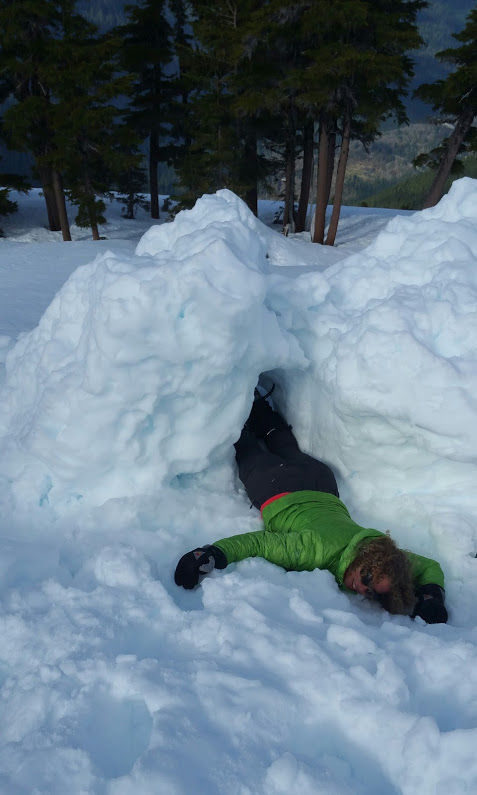
 Ok, ok, I wasn’t really dead! 😉
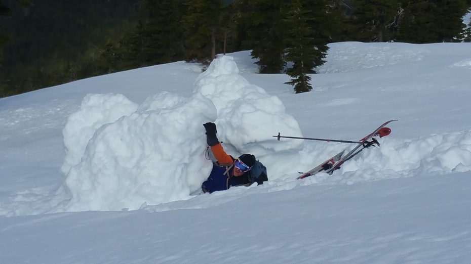
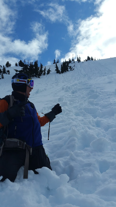


 Sure as shit beats hauling out blue bags, eh?